
CliffMetrics for SAGA GIS
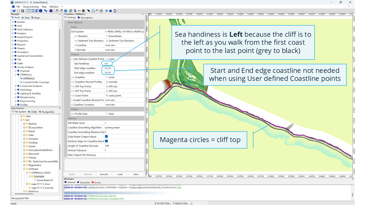
CliffMetrics automatically delineates coastline locations, coastline normals, and cliff top and toe positions along coastal areas. It's integrated into SAGA-GIS version 8.2.3+ under the Terrain Analysis → Coastal Morphology menu.
Contents
This text will be replaced automatically with the TOC (h4, h5) in the published version (not visible in the Preview). See class episode-body to change format.
Why it matters?
CliffMetrics matters because identifying cliff‑top and cliff‑toe positions is far less straightforward than it first appears. Real coastlines are messy: slopes blend into each other, vegetation and land use obscure breaks in slope, and digital elevation models introduce their own quirks. CliffMetrics was built to help users navigate this complexity by providing a quick, transparent, and easy‑to‑tune workflow that lets them test different settings and choose the combination that best reflects their own interpretation of where the cliff actually begins and ends. Rather than forcing a single “correct” answer, it gives users control, flexibility, and reproducibility. This approach has been used at national scale, including in the NCERM2 project, to support consistent and defensible cliff‑line mapping across the UK.
This software and additional supporting material can be found in the official repository and in dedicated LinkedIn URL shown below.
Related content
Thank you! Your submission has been received!
Oops! Something went wrong while submitting the form.

coastalgeohazardsexperts.co.uk
Coastal Geohazards Experts Ltd. Registered Number: SC873383. Registered in Scotland. Correspondence address: Murchison House, 10 Max Born Crescent, EH9 3BF, Edinburgh, United Kingdom. Copy Right (c), Coastal Geohazards Experts Ltd, 2026. All rights reserved. "Dr Andres Payo" is a trading name of Coastal Geohazards Experts Ltd.